KARLOS: Mountain-top cubesat demonstrator for urban AQ monitoring at sub-hectometer spatial resolution

Mountaintop cubesat demonstrator for urban AQ monitoring at sub-hectometer spatial resolution
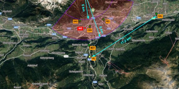
Text: In collaboration with Luftblick OG, BIRA the consortium will build, test and validate a new observing system for spatially resolved NO2. Relating NO2 columns to surface NOx emissions is commonly based on a multi-staged cascade of modeling and data reduction approaches. Here we aim to constrain these reductionist approaches by direct observations of surface fluxes in combination with a high resolution emission model and a second order closure model of the PBL. A CTM approach in complex topography is currently difficult to implement within the scope of this proposal, as it would need to constrain transport phenomena at Large Eddy Simulation (LES) resolution. In order to achieve the required milestones of this call we propose an alternative approach by constraining simpler modelling approaches by direct chemically resolved surface flux and concentration data (section 1.1.3.5), with an objective to obtain first quantitative emission estimates along a narrow Alpine valley, that can be regarded as one of the NOx emission hotspots in the European Alps.
Project Leader:
Karl THOMAS
Members:
Christian LAMPRECHT
Funding Acency:
ESA subcontract
Project Duration:
01.05.2022 - 31.12.2023

