
Diese Webseite ist archiviert. Unter Umständen sind nicht alle Inhalte barrierefrei. Weitere Informationen finden Sie in unserer Erklärung zur Barrierefreiheit.
|
Stubai Valley |
The Stubai Valley in ![]() is a side valley of the Wipp-Valley in the Tyrolean Alps. The Wipp Valley is
located between the Brenner Pass and Innsbruck on the route from Austria to
Italy. The main village of the Stubai Valley is
Fulpmes.
The investigation sites of
ECOMONT are situated in the district of
Neustift
im Stubaital.
is a side valley of the Wipp-Valley in the Tyrolean Alps. The Wipp Valley is
located between the Brenner Pass and Innsbruck on the route from Austria to
Italy. The main village of the Stubai Valley is
Fulpmes.
The investigation sites of
ECOMONT are situated in the district of
Neustift
im Stubaital.
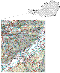
Figure 1: Map of the investigation sites at the research area "Kaserstattalm" in the Stubai Valley
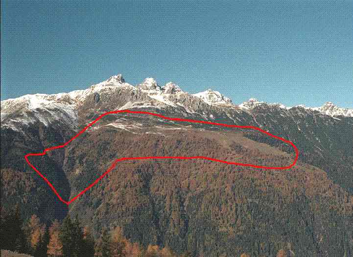
Figure 2 |
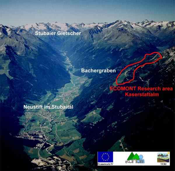
Figure 3 |
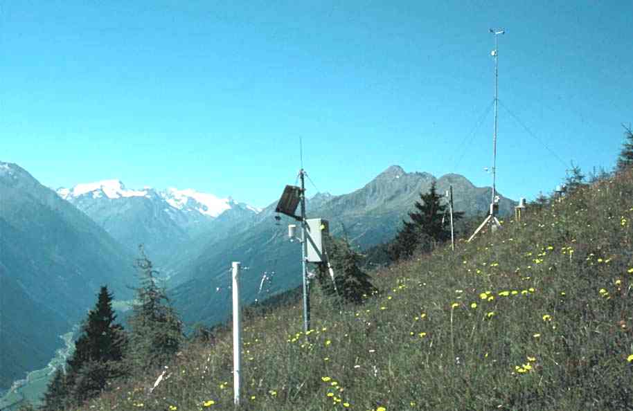
Figure 4 |
Figure 2: The ECOMONT research area "Kaserstattalm" as seen from the opposite side of the valley.
Figure 3: The ECOMONT research area "Kaserstattalm", as located above the village "Neustift im Stubaital", Austria. Whilst the project ECOMONT investigates primarily the ecological changes in the managed and abandoned meadows and pastures belonging to the Kaserstattalm (area marked by red line), an INTERREG II project analyses effects on the municipality of Neustift. The latter focuses on identifying possible effects of land-use changes occurring on the Kaserstattalm on potential risks in the side-valley Bachergraben (danger of torrents and avalanches). Photo: Alpine Luftbild-GmbH & Co.
Figure 4: View over the lightly managed area. In the background you can see the glacier "Stubaier Gletscher".