The WP8 team identifies similar development regions in the Alpine space. Under consideration of the relevant driving forces and landscape-factors, objective (statistical data from census, satellite, etc.) and subjective data on municipality level (survey amongst political stakeholders on the different cultural perceptions of sustainable development) will be combined and fed into a GIS-based datapool. The analysis of the data will reveal similar development regions in the Alps.
The extension call of the Alpine Space Programme was used to request additional money to be able to produce an atlas comprising the Alpine wide maps produced in DIAMONT. This request was approved in December 2006. In cooperation with all partners the EURAC will work on a concept for the atlas from January on.
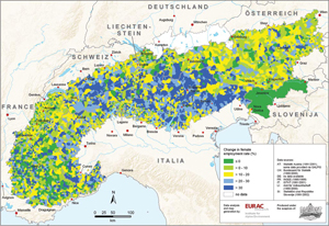
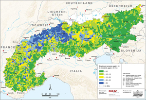
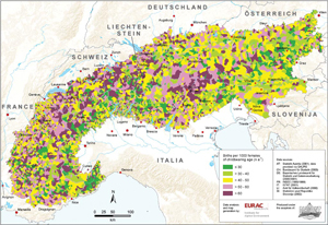
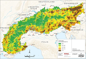
One of the most important objectives of WP8 was to implement an identification of Alpine wide local centres and fringes. These data are useful for the delineation of the test regions, in which the urbanization process as main focus of DIAMONT will be analyzed. Moreover in some selected regions the tools which have been worked out in WP9 will have to be elaborated and optimized in order to stimulate and steer regional development. To this purpose two workshops will take place in each region (see WP10 and WP11). The delineated regions we are talking of are „Labour Market Regions“ (LMR), see map. In their centre there is a Labour Market Centre (LMC) that is a municipality or city with following features:
• more than 10.000 inhabitants or
• more than 5.000 employees and
• a positive commuter balance.
|