 | ||||||||||||
Projects
| Dinner at the „Arzler Alm“General Information:
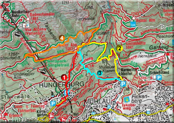
The Arzler Alm is at an altitude of 1.067m above the roofs of Innsbruck. The starting point for the walk is the parking lot of the “Nordkettenbahn”. Time required: 30 min Difference in Altitude: app. 200 m Length: app. 4 km.
Address: Arzler Alm
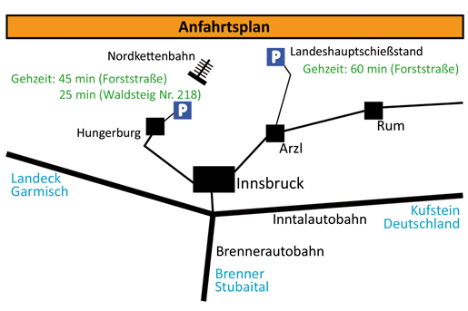
Walk to the Arzler Alm: We’ll arrange a bus "Busreisen Heiss" for the trip to the lower terminus of the Nordkettenbahn (Hungerburg Bahn). The bus waits in front of the University and will leave at 18:00. You can take several paths to hike up, like the “Waldsteig” No 218 (time required: 30min) or the “Rosnerweg” (Arzler Alm Weg – 60 min). All paths are signposted.
There is one bus organized for your way back at 22:30. Otherwise you can take public buses (time table see below) and don’t forget flashlights because the path is not lighted.
By Car: Drive through Innsbruck to the Hungerburg (the whole way is signed). There is a free parking area at the “Sparmarkt Hungerburg”, approximately 200 m before the lower terminus of the Nordkettenbahn.
| |||||||||||


